254 Texas Courthouses
  • Home
  • Chronological Order (of my visits)
  • County List (alphabetical)
  • County Seat List (alphabetical)
  • Texas Courthouse Blog
  • James Riely Gordon, Architect
  • Eugene T. Heiner, Architect
  • Henry T. Phelps, Architect
  • Alfred Giles, Architect
  • Corneil G. Curtis, Architect
  • Wesley Clark Dodson, Architect
  • Lang & Witchell Architects
  • Voelcker & Dixon, Architects
  • Wyatt C. Hedrick, Architect
  • David S. Castle, Architect
  • Page Brothers, Architects
  • James Edward Flanders, Architect
  • Pierce, Norris, Pace & Associates, Architects & Engineers

Permian Basin Road Trip Day Four

7/30/2012

1 Comment

 
Picture
Andrews County landscape
Sunday, July 29, was my last day in the Permian Basin.  I checked out of my hotel and drove north on US Highway 385, leaving Ector County and entering Andrews County.  The landscape, typical of the Permian Basin, was dotted with "pump-jacks" and laced with electical lines, powering the pumps that bring the oil to the surface.
Picture
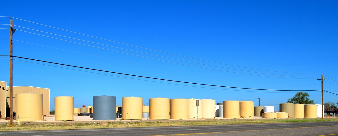
Andrews County tankscape
I photographed the Andrews County courthouse in the square and then headed north on 385 again.  Along the way I passed a tank manufacturing facility and this wonderful tankscape.   North of Andrews County I entered Gaines County.  Approaching the county seat, Seminole, I encountered a feature familar to anyone who has driven the roads of Texas:  the reststop.  This particular design must date from the 1960's.  I've seen it everywhere. 
Picture
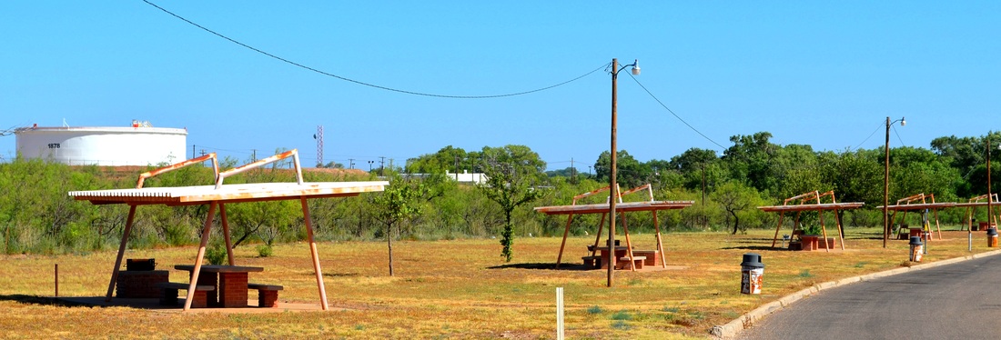
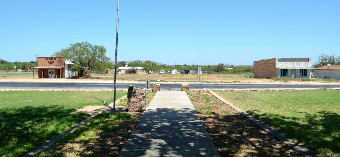
Reststop on US 385, south of Seminole
As a child in the 1950's and early 60's I ate many meals with my family in road side shelters like these in Seminole.  Travel by car in those days was slower and places to eat were not as plentiful in this pre-fast food era.  We'd pack a meal and stop along the road to eat and rest before continuing our drive across Texas, with the windows down.  Automobile air-conditioning was still a rare luxury.  The Gaines County courthouse was soon photographed and I turned east on US Highway 180 for Lamesa, seat of Dawson County.
Picture
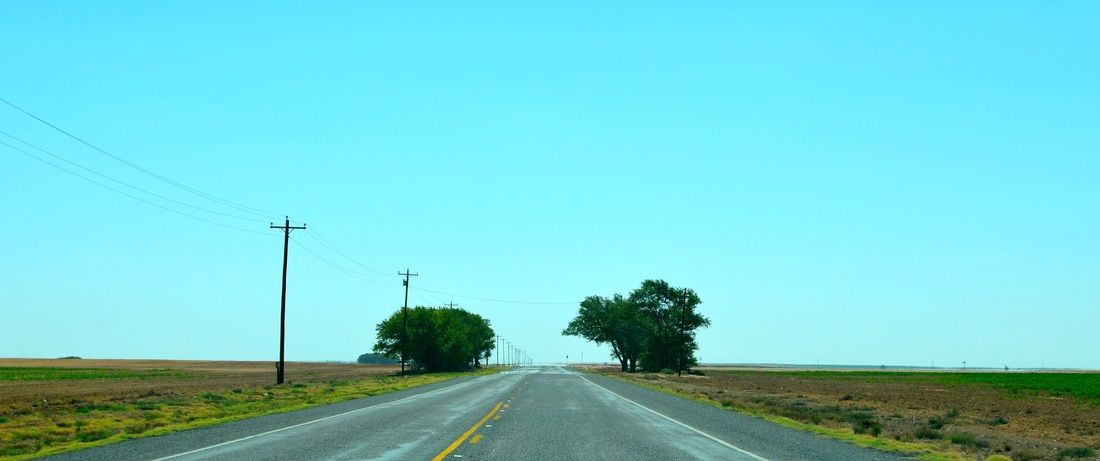
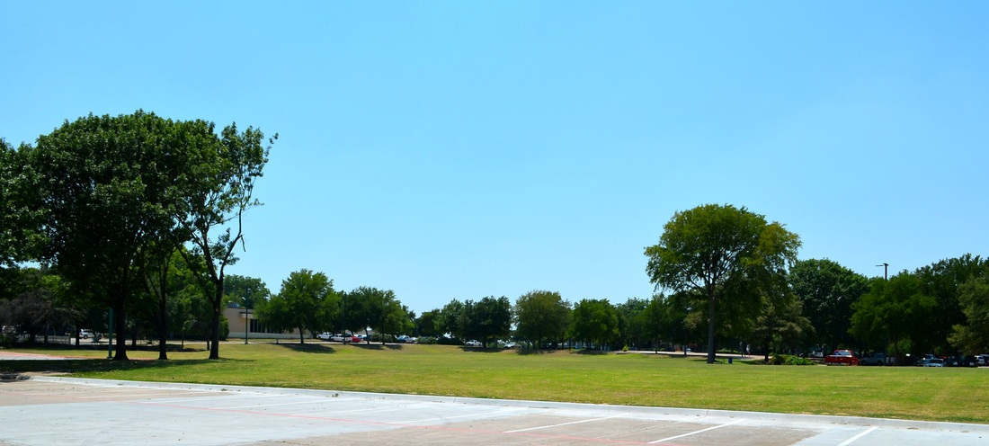
Gaines County landscape with trees
The northern edge of the Permian Basin is in the Llano Estacado, or Staked Plain, also known as the Caprock.  The land is flat and highly cultivated.  The trees flanking the highway were a nice touch; a break in the monotony.
Picture
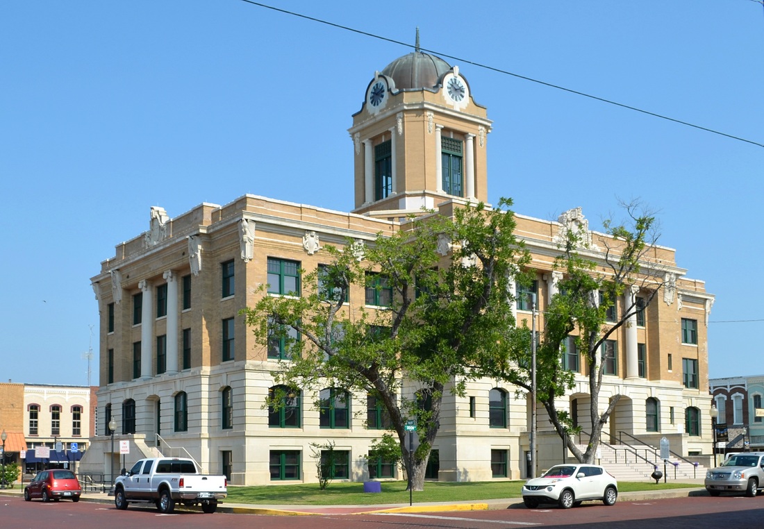
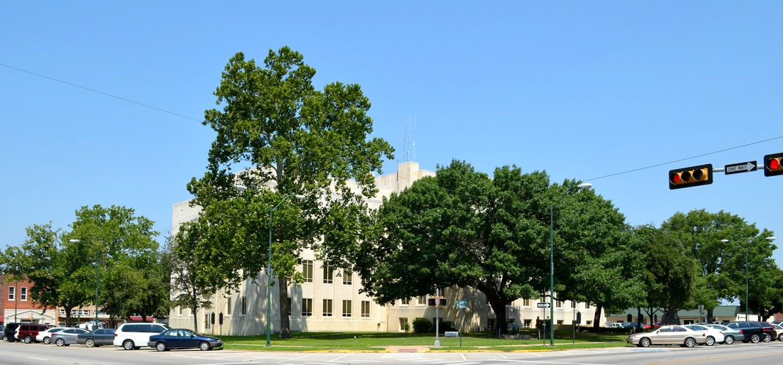
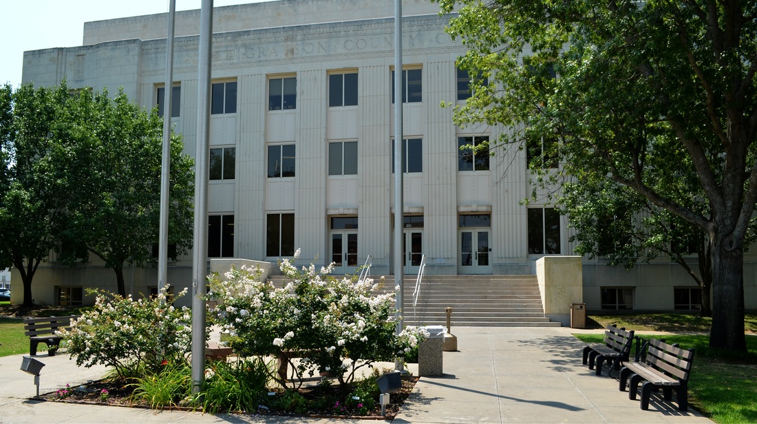
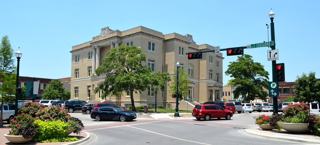
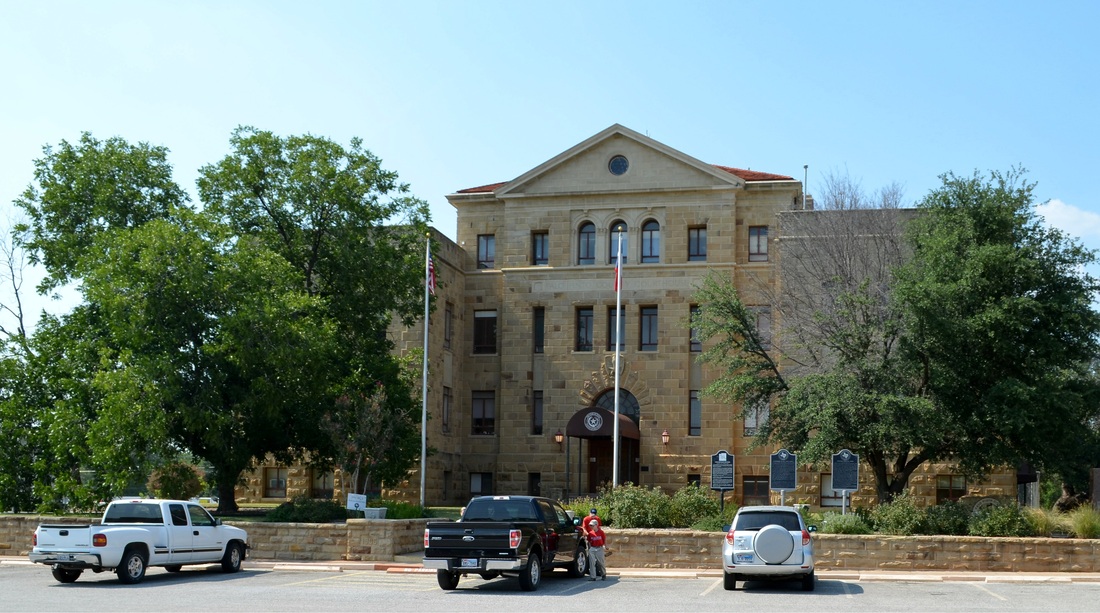
Dawson County courthouse, Lamesa
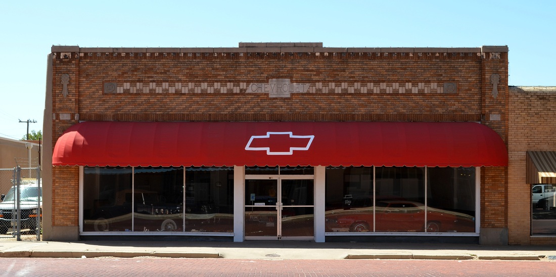
The Dawson County courthouse is very sad.  It's been altered beyond recognition and begs for restoration.  At least it's hidden in a grove of mature trees.  The area surrounding the courthouse square in Lamesa contains a number of interesting historic buildings, including this former Chevrolet dealership which now houses classic cars.
Picture
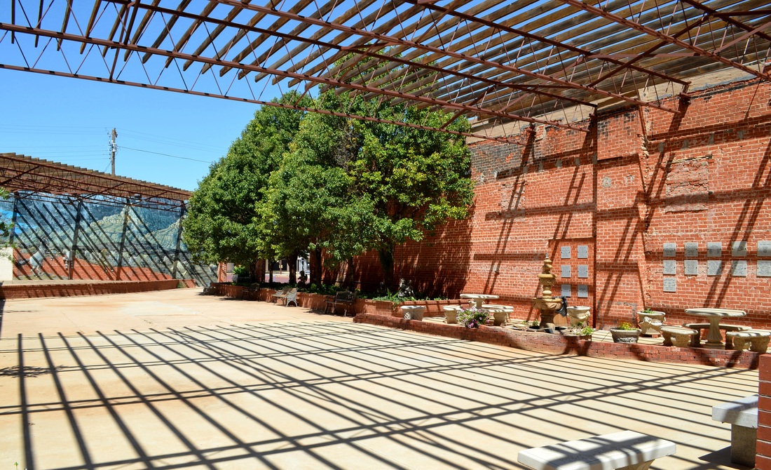
There's also this wonderful example of reusing the shell of a building:  the Courtyard in downtown Lamesa.
Picture
Lamesa, seat of Dawson County, was the 15th and last of my Permian Basin counties.  In addition, this was the 11th and last of the county seats I've visited that are connected by US Highway 180 as it crosses Texas, from Fort Worth to Seminole.  With plenty of time left before my flight to Houston, I continued east on 180 and returned to the first county courthouse I'd photographed:  Borden County.  The landscape changes dramatically in the drive between Lamesa and Gail.  Leaving Lamesa it's typical Caprock farming scenes.
Picture
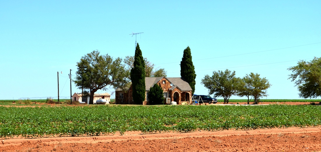
Rock house, check. Suburban, check. Swamp cooler, check. Butane tank, check. Cedar trees, check. Tall television antenna, check. Surrounded by cotton plants, check. Got it all.
Suddenly, the Llano Estacado ends and the road descends into a very different landscape.
Picture
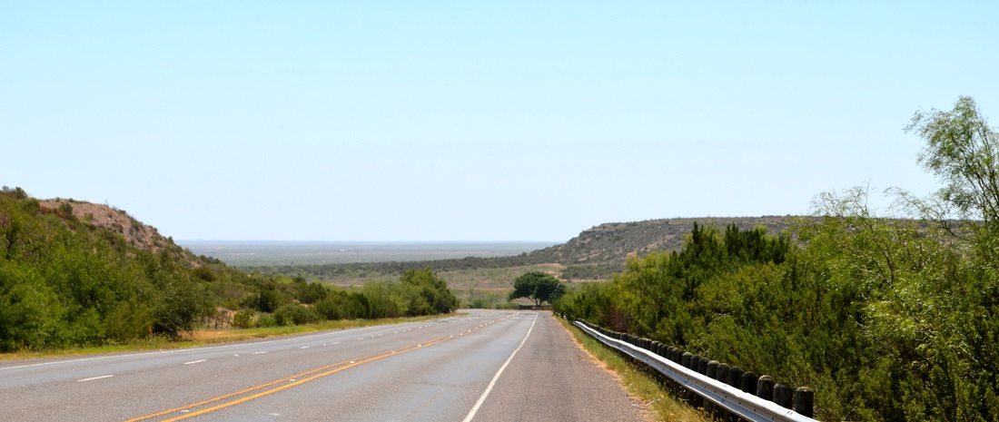
US Highway 180 eastbound in Dawson County
In a few minutes I entered Borden County and a world of cattle ranches, mesquite trees and mesas as far as the eye could see.  In the center of the county I stopped in Gail and photographed the courthouse I'd first shot in May 2007.
Picture
View from the front of the Borden County courthouse in Gail
Not much had changed in Gail in the 5 years since my first visit.  Leaving Gail, I turned south on FR 669 and headed for Big Spring.  The road was empty of traffic.  I stopped several times to photograph the landscape, especially Mushaway Peak, an erosional remnant of the Llano Estacado that forms a conspicuous butte that stands on high ground between tributaries of the upper Brazos and Colorado rivers.
Picture
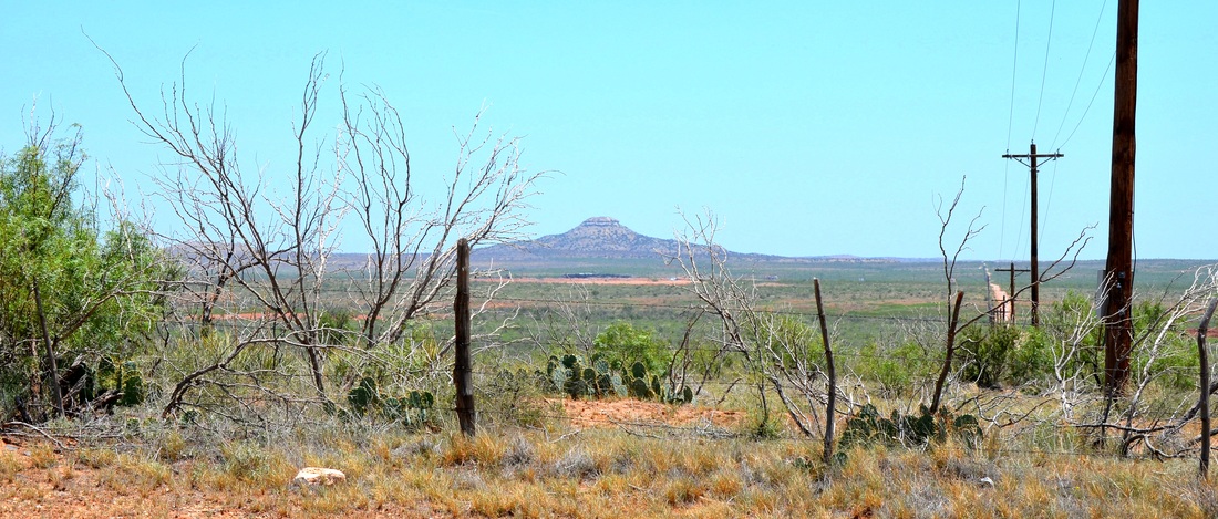
Mushaway Peak, Borden County
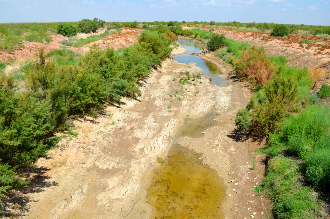
Further south I crossed a bridge over what the sign claims is the Colorado River.  You be the judge of whether this is the same "river" that crosses Texas and past eight county seats, from Colorado City to Wharton.
Picture
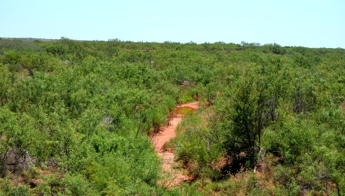
The Colorado River in Borden County
I soon left Borden County and entered Howard County where I picked up I-20 and headed west.  Arriving in Midland with an hour to spare I stopped to visit the Petroleum Museum.  It's worth a trip.  Here's part of their amazing collection of various pump-jacks. 
Picture
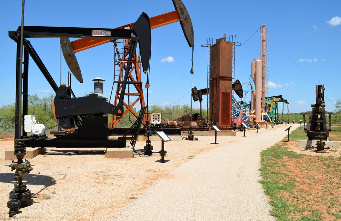
Outdoor exhibits at the Petroleum Museum in Midland
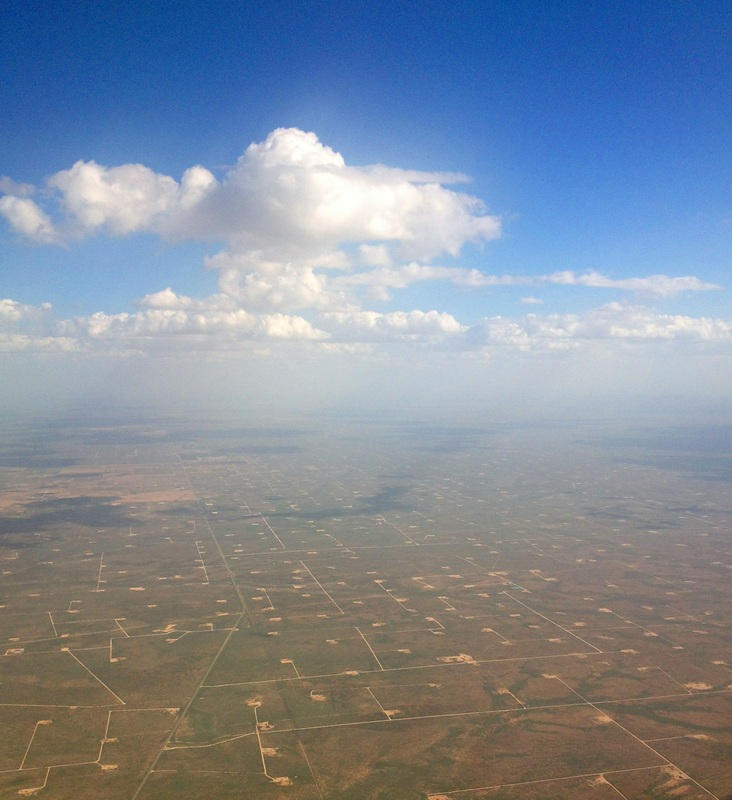
With the temperature at a more seasonal 100 degrees, I dropped off my Chevy Malibu and entered the Midland International Airport terminal.  My flight to Houston was on time.  Climbing out of Midland, we crossed the Permian Basin with its distinctive pattern of oil wells and connecting roads.  What a rich landscape!
Picture
1 Comment

Permian Basin Road Trip Day Three

7/28/2012

0 Comments

 
(When I return home from this road trip I will blog about the courthouses I've visited this weekend.  For now I'll confine my remarks and photographs to the landscape and other points of interest, to me, at least.)
Picture
Ector County landscape with barrels
This morning I left Odessa, in Ector County, and drove west on I-20.  First stop, Monahans, seat of Ward County.  Yet another courthouse facade hidden behind trees.   Back on I-20, moving into Reeves County the speed limit went from 75 to 80 MPH.  At that speed I could have reached El Paso in less than 3 hours.  Instead, I pulled off the road in Pecos, where I photographed the courthouse (more trees obscuring the front of the building) and had lunch. 
Picture
I-20, Highway 285 overpass in Pecos, Texas
Full of TexMex food, I headed north on US Highway 285 and then turned east on Texas Highway 302, crossing the Pecos River and entering Loving County.  The Pecos River runs 926 miles from the mountains of New Mexico to the Rio Grande River in Texas. North of the Highway 302 crossing, a dam creates the Red Bluff Reservoir.  Therefore, the Pecos River is not much of a river where I crossed it this afternoon. What water there was came from rains the previous 2 days.
Picture
The Pecos River forms the boundary between Loving and Reeves Counties in West Texas.
I have been looking forward to visiting Loving County for several years.  Ever since I learned that it is home to the fewest citizens of any county in Texas, 82 of them in the 2010 census.  Since I live in the county with the largest population in Texas, Harris, with over 4 million people, visiting a county with so few people was something to look forward to on my courthouse tour.  Well, Loving County, like all of the Permian Basin is very busy with oil drilling activities and was not the quiet, isolated place I imagined.  Traffic on 302 was non-stop and never quiet!  Too many trucks and pickups for that.  Here's a photograph taken from the Pecos River bridge at the county line.
Picture
Welcome to Loving County, Texas
My guess is there are more than 100 people residing in Loving County now.  The small crossroads community of Mentone, the only "town" in the county, is home to a small, 1935 era courthouse and, to my surprise, a new courthouse annex, too.  Progress has come to Loving County.  One photograph from Mentone:  the small community church, dating from 1910.  It's the oldest building in the county.  Not that there are many buildings in Loving County...
Picture
Mentone community church. Built 1910 in Porterville and moved to Mentone in 1930 after Porterville was destroyed by a flood.
From Mentone I continued east on 302 into Winkler County and Kermit, the county seat and home to Jim Sharp.  Once again, the front facade of the courthouse, a David Castle design, is almost completely hidden by mature trees. 
Picture
From Kermit I drove east and passed north of Odessa on my way to Midland, seat of Midland County.  The Midland courthouse is another example, like Scurry County, for instance, of the art of absorbing an older courthouse building into a brand, new modern courthouse!  However, more surprises awaited me in downtown Midland.  Signs in the doors of the courthouse announced a move to a new county courthouse!  I will have to find out what's going to happen to the old one.  The new courthouse is just a few blocks north and is a make-over of an existing highrise office building.  Very boring, but, I'm sure, practical and efficient, and a good use of the taxpayers money, etc.
Picture
Sign on Midland County courthouse door
Picture
You can just make out a portion of the "old" courthouse in this view from the corner of the "new" courthouse in Midland.
I'll be on the road tomorrow, visiting Andrews, Seminole, Lamesa, and, for a second time, Gail, before returning to the Midland Airport and my flight to Houston.
Now, back to the Olympics on NBC...
0 Comments

Permian Basin Road Trip Day Two

7/27/2012

1 Comment

 
Picture
Day two began with an 8:00 AM departure from my hotel in Odessa.  I arrived back at the hotel a few minutes before 5:00 PM.  A long day, a good day.  I'm tired.  7 new counties: Martin, Howard, Glasscock, Reagan, Upton, Crane and Ector.  The morning weather was nice but warm.  Then, in the afternoon the thunderstorms formed quickly and I found myself in some very heavy rain as I drove from Rankin to Crane on Texas 329.  And, the temperature dropped to 68 degrees in the middle of the afternoon! 
The photograph above sums up the day:  dark clouds and oil.  (The flames are burning off natural gas.) This part of the Permian Basin is very busy.  I was nearly run off the road more than once by large trucks moving very quickly (80 mph +) on 2 lane roads.  Lots of drilling rigs everywhere. 
Picture
Rain begins to fall in Rankin, seat of Upton County
Saturday I will turn west, visiting Monahans in Ward County, Pecos in Reeves County, Mentone in Loving County, and Kermit in Winkler County.  Loving County is, of course, the least populated county in Texas.  In 2010 its total
population was 82 people.  Just by visiting I'll raise the population significantly! 
Now, back to the Olympics...
Picture
A beautiful rock facade on the First Baptist Church in Garden City, Texas. Seat of Glasscock County.
1 Comment

Permian Basin Road Trip Day One

7/26/2012

0 Comments

 
Left Houston Hobby Airport this afternoon on Southwest Airlines flight 2888, bound for Midland.  As usual these days, the flight was full and left late.  Mark, in the middle seat, and I talked the entire trip, making the time pass quickly.  Of course, we discussed Texas counties and courthouses, too.  As we approached the Permian Basin the weather became an issue:  thunderstorms were filling the afternoon skies.  The flight attendants sit down as the aircraft wove between impressive thunderheads on approach to the airport.  From my window I had a view of hundreds of oil wells scattered across the landscape, connected by roads that, from the air, created an intricate, organic pattern. 
We landed in a light rain that turned heavy as I was about to leave the terminal in search of my rental car.  I hadn't thought to bring an umbrella!  After waiting a bit, I gave up and accepted my wet fate.  The temperature was 73 degrees as I left the airport.  Not the west Texas I remember.  I drove through the cool rain to Odessa, on the Black Sea.  No, Odessa, on the Permian Basin.  It always reminds me of an early record album by the Bee Gees titled "Odessa."  I have a copy at home, completed with a red velet cover.  Really.
Back on topic.  I checked into, where else, a Marriott in Odessa, across the street from the Music City Mall.  Huh?  Is Odessa the "music city?"  I'll look into that later. 
Friday morning, I'll begin a 3 day, 15 county road trip through the Permian Basin of Texas.  East on I-20 past Midland to Stanton and Big Spring, then south to Garden City and Big Lake.  Turning west at Big Lake to Rankin and then northwest to Crane before returning to Odessa.  About 235 miles total.  I'll visit 6 county seats, plus 2 ghost towns that were former county seats and the ruins of their courthouses. 
Goodnight.

0 Comments

Rockwall County

7/22/2012

1 Comment

 
First, thanks to all of you who alerted me to the typo in my last blog post.  It's Rockwall County, not "Rockwell." 
Second, I've spent some time looking into the size of this, the smallest county in Texas in area.  Here's a brief history of the county from the Rockwall County website:
"In 1836, the area was established as part of Nacogdoches County, and when Texas  joined the Union in 1845, it was included in Henderson County. Kaufman County was formed in 1847, and the region now known as Rockwall County was placed in Kaufman County. Citizens thought the county seat of Kaufman was too inconvenient, and in 1873, Rockwall County was formed."
The county website says this about the size of Rockwall County:
"Rockwall County is the smallest county in Texas, covering only 147 square miles."
This number agrees with the Texas Historical Marker text found in the 100 block of S. Goliad Street in Rockwall:
"First settled in the 1840s, this region was a part of Kaufman County until 1873, when Rockwall County was created.  With an area of 147 square miles, this is the smallest of Texas' 254 counties.  The county and city of Rockwall were named for an underground formation of rock discovered in the early 1850s.  Crossed by the Missouri, Kansas & Texas Railroad, Rockwall county is an area of fertile farmland.  The location here of the aluminum industry and the creation of Lake Ray Hubbard from the East Fork of the Trinity River diversified the local economy in recent years.  (1976)"
On the other hand, Wikipedia lists a different area for Rockwall County:
"According to the U.S. Census Bureau, the county has a total area of 149 square miles (390 km2), the smallest county in Texas, of which 129 square miles (330 km2) is land and 20 square miles (52 km2) is (13.39%) water."
Going to the U.S. Census Bureau's Rockwall County "Geography QuickFacts" website, I find that the area of Rockwall County in 2010 is 127.04 square miles.  I believe this "area" is in fact, dry land area, not including the portion of the county that is underwater. 
I'm going with the official Rockwall County website:  147 square miles.
Which brings up an interesting fact about Rockwall County.  Approximately 14% of its original land area was flooded in the late 1960's to create what is now Lake Ray Hubbard.  Think about it:  for the smallest county in Texas a "loss" of 14% percent of its buildable (and taxable) land (about 20 square miles) is a significant event!  On the other hand, the county suddenly had a LOT of new waterfront property.
Here's some background on what Lake Ray Hubbard:
"Ray Hubbard Reservoir is a 22,745-acre impoundment constructed on the East Fork of the Trinity River by the City of Dallas in 1968 to provide water for municipal, industrial, and recreational purposes. Ray Hubbard Reservoir is located one-mile east of Rockwall and lies within Dallas, Collin, Rockwall and Kaufman counties."
Let's compare some maps of Rockwall County to see the impact of Lake Ray Hubbard on the county.  For these maps, I have to credit and thank a website I found today while researching this topic:  THE PORTAL TO TEXAS HISTORY.  The website is http://texashistory.unt.edu/
Here's their description of this remarkable online resource: 
"The Portal is a gateway to Texas history materials. You may discover anything from an ancestor's picture to a rare historical map. From prehistory to the present day, you can explore unique collections from Texas libraries, museums, archives, historical societies, genealogical societies, and private family collections. The Portal continues to grow as additional partners contribute digital versions of their collections. We hope you'll return often to discover our latest additions."
Back to Rockwall County.  I spent a lot of time online searching for downloadable maps of the county illustrating conditions "before" Lake Ray Hubbard was "impounded" in 1968-70.  I had very little success until I stumbled across The Portal to Texas History website.  I can already tell that The Portal to Texas History will join my list of "go to" websites as I work on the Texas Courthouse website.
Let's start with a Land Map of Rockwall County from 1874, a year after the county was formed.  I've overexposed it so you can see the land plats.  The East Fork of the Trinity River runs north-south just inside the western boundary of Rockwall County, on the left side of the map.  The East Fork of the Trinity River would, in 1968, become Lake Ray Hubbard.  But, in 1874 it was just a river.  (The dark line running west to northeast across the county is a railroad.)
Picture
Clearly, at the time, a lot of people owned land in what is now a lake.  Here's another "before" view.  A 1923 county soils map that also illustrates the pre-lake county lands.
Picture
The soil "types" are color-coded and the green color on the west side of the county indicates "Trinity Clay" soils.  Below, are two road maps of Rockwall County.  The one on the left is dated 1961.  The one on the right is from 1972.
Picture
Rockwall County TX roads 1961
Picture
Rockwall County TX roads 1972
The impact of Lake Ray Hubbard on the geography of the county is very apparent.  Like I said, a lot of new waterfront property was created.  Here's a larger image of the 1972 map.  Notice that portions of Rockwall County on the west side of the lake (in the red rectangle) were now physically separated from the rest of the county.  If you're in the part of Rockwall County west of the lake and north of Interstate 30, look for Dalrock Road.  It's median is the dividing line between Rockwall and Dallas Counties.
Picture
From what I can tell, Rockwall County is substantially better off as a result of flooding 20 square miles of it's 147 square miles.  All joking aside, the land lost to Lake Ray Hubbard isn't missed.  The new recreational uses of the lake, not to mention the source of water for the surrounding area, is a positive improvement, and the waterfront property in Rockwall County is proving very valuable as this county has become a highly desirable address in the Dallas area.
(Next Saturday, July 28, I'll be visiting Loving County, the other "smallest" county in Texas, with a population of 82.)
1 Comment

Names

7/14/2012

1 Comment

 
Many Texas counties share their name with the county seat.  I haven't counted them, but it's not uncommon.  Think of Bandera, Bastrop, Burnet, Dallas, Denton, Eastland, Galveston, Goliad, Gonzales, and so on...
A few add the word "City" to the county seat, but they're otherwise the same name.  For example, Karnes City is the seat of Karnes County and Sterling City is the seat of Sterling County.
Of the 158 counties I've officially visited, three of them take a different approach.  The name of the county and the name of the county seat are taken from the first and last name of the person (Okay, the man, I have yet to visit a county named after a woman!) the county is named after.  To wit.
1.  Gail (county seat of), Borden County:  Gail Borden
2.  Anson (county seat of) Jones County:  Anson Jones
The third county got it backswards for some reason.
3.  McKinney (county seat of) Collin County:  McKinney, Collin
This intrigues me.  Why would the county have been named for Collin McKinney and used his first name in lieu of his last name?  It's not as if there was already a McKinney County.  Any ideas why it's "Collin" County and not "McKinney" County?
Regardless of its backwards name, Collin County is sure growing quickly!  Click here.
To change the subject, just how "small" is Rockwall County?  I've found figures of 147 and 149 square miles online and even 129 square miles, if you subtract the 20 square miles of the county that are under water!  On Monday I'm calling the county to find out the official size of this little bitty county. 
1 Comment

June 2012 Courthouse Road Trip Day Two

7/2/2012

1 Comment

 
Picture
Thursday, June 28.  Up early and looking for distant views of the Denton County courthouse.  The view from the Texas Women's University campus was perfect.  In the morning light the courthouse towers looked sureal.
Picture
This W.C. Dodson designed courthouse has been preserved and now serves as a museum and offices for the county.
Picture
Headed north on I-35 and soon arrived in Gainesville, seat of Cooke County.  A couple of more miles and I would have crossed the Red River into Oklahoma.  The tower of the Cooke County courthouse is visible on the skyline.
Picture
The 1910 era courthouse occupies the center of a square in downtown Gainesville.  The building was designed by the Dallas firm of Lang & Witchell in a Beaux Arts meets Louis Sullivan/Frank Lloyd Wright design that is very handsome,
very much like the Johnson County courthouse in Cleburne by the same architects.  I especially enjoyed the newly restored interiors.  The colors and applied ornament, including the metal railings, are simply beautiful.
Picture
Gainesville is a railroad town so please indulge my passion for photographing trains and train stations.
Picture
Turning east at Gainsville, I drove to Sherman, seat of Grayson County.  It was noon so I parked in the courthouse square and began looking for a restaurant.  I couldn't help but notice that the Grayson County courthouse was surrounded by trees!  This would be yet another difficult building to capture whole!
Picture
Across Travis Street from the courthouse I came a upon a restaurant with a most interesting name:  Fulbelli's!  The location was in a historic building, Kelly Square, that featured a mall-like interior.  The restaurant was on the mezzanine level and included a carriage.  I wonder how that found its way up the stairs.
Picture
I had a delightful meal and soon understood the true meaning of the restauarant's name.  Think about it...
Picture
Corn chowder with breaded and grilled Jalapeno's. Delicious!
Here's another plug:  www.facebook.com/fulbellis
Picture
Voelcker & Dixon, Architects, 1936.
With a full belly I made my way out into the heat of north Texas and circled the Grayson County courthouse, looking for a break in the trees through which I could see the entire building.  Alas, it's not possible.  I did find the twin courtrooms on either end of the second floor to be beautiful examples of a restrained neo-classical modernism.  And, they still have the original wall-mounted fans!  Please don't ever take them down!
Picture
Time to move on.  I merged into heavy traffic on southbound U.S. Highway 75 and headed for Collin County.  The guidebook to Texas Courthouses by Dr. Kelsey illustrates the 1979 Collin County courthouse in McKinney.  It's brown brick and has all of the majesty that a 1970's "modern" office building could muster.  Regardless, the guidebook promised that the earlier, historic courthouse still survived a few blocks from the new courthouse.  Here's the 1874 (remodeled in 1927) courthouse in the McKinney square.  It's now a performing arts center surrounded by a very up-scale shopping/dining district.
Picture
Hands down the winner of the best landscaped courthouse square!
I circled the square and wilted in the 100+ degree heat.  Finding a cool gelato shop, I stopped for a vanilla-rasberry swirl gelato and a glass of water.  "Where is the new courthouse from here?" I asked the clerk.  "Oh, they tore that one down and built a new courthouse up on Highway 75,"  was the answer.  Huh?  Built in 1979 and already gone!  Collin County IS growing very quickly.  To confirm, I walked a couple of blocks to the location of the "new" courthouse and found this.  Having seen photos of the now demolished courthouse, I have to say this is a great improvement...
Picture
Since I'd driven right past the latest "new" Collin County courthouse on my way into McKinney and not noticed it, I decided in the interest of time to proceed on to Rockwall County and save the current Collin County courthouse for another trip.  You can find images of it and the 1979 version online if you're interested.  Just search for Collin County courthouse photographs.  Leaving McKinney, I drove east and then south to Rockwall County, the smallest, by area, county in Texas.  At about 11 miles square, it's truly a small county.  Take a look at the map on the Rockwall County page.  Given the size of the county, the diminutive courthouse is just right.  A dollhouse of a courthouse, if you will.
Picture
Of course, this being Texas, the building is surrounded by trees and vehicles.  Here's the front view of the courthouse.
Picture
And, so I reached county number 158.  Weary, but not worn, I joined the cars and trucks on I-30 and headed west, into Dallas County.  It took an hour, but I reached Love Field in time for my flight to Houston on Southwest Airlines.
1 Comment

June 2012 Courthouse Road Trip Day One

7/1/2012

0 Comments

 
I traveled to Fort Worth on business on Wednesday, June 27, and then took a vacation day in order to visit 5 counties in the DFW area.  I also took the opportunity to take additional photographs of the Tarrant County courthouse in Fort Worth.  The high temperature each day was well over 100 degrees and there wasn't a cloud in the sky.  Thank goodness for air-conditioning!  It was so hot the mounted police were resting their horses in the shade in front of the Tarrant county office building.  They attracted the attention of some passing children.
Picture
I'll be updating the Tarrant County page soon with new photographs of the historic courthouse and various county buildings in the vicinity of the courthouse.  Meantime, here's a view of the historic courthouse and the adjacent post-modern civil courts building, now closed for reasons I'll have to discover.
Picture
Tarrant County courthouse
Picture
Signs on the doors announce "building closed"
I completed my business in Fort Worth in time to take a late afternoon drive west through Weatherford (Parker County) and into Palo Pinto County.  On my way through Weatherford, seat of Parker County, I stopped long enough to take some photographs of the W.C. Dodson designed courthouse from the west, on US Highway 180.  This highway passes through 10 county seats between Fort Worth and the New Mexico state line.  I've now visited 8 of the 10 and by the end of July I will have photographed all 10 courthouses on US 180.
Picture
You can't miss the Parker County courthouse!
Palo Pinto County's seat is Palo Pinto, a very small town (less than 500 population) in the center of the county.  The 1940 era courthouse dominates the town square. 
Picture
Palo Pinto courthouse
Picture
Downtown Palo Pinto
I also found another wonderful "rock" building in Palo Pinto:  the Methodist Church.
Picture
Love the sign!
Running through the middle of Palo Pinto County is the Brazos River.  Highway 180 crosses the river between Palo Pinto and the largest town in the county, Mineral Wells.  I stopped to photograph the river from the highway bridge and wished I could join the people enjoying the cool(er) waters on that hot summer afternoon.
Picture
The Brazos River, north of the US 180 bridge in Palo Pinto County
Mineral Wells, largest community in Palo Pinto County, is located on the eastern side of the county.  Mineral Wells, with a population under 20,000, is home to a very large and very empty relic of its past, the Baker Hotel.  Opened in 1929 to cater to the needs of Texans looking to enjoy the mineral springs for which the town in named, the Hotel Baker stands 14 stories high.  Here's a postcard view:
Picture
It closed its doors in 1963. And it's still around in 2012.  To learn more about this fascinating building and the city that surrounded it, go to http://www.bakerhotel.us/  Here's a current view of the abandoned building. 
Picture
The Baker Hotel, Mineral Wells
Mineral Wells is home to many historic buildings, but the Baker Hotel "stands" out given its size and height.  Mineral Wells is less than an hour's drive from Fort Worth.  It's worth the visit.
I finished my day in Denton, where I spent a restful night in the Fairfield Inn on I-35W.  I had dinner at a local Italian restaurant that shall remain nameless.  Let's just say the food was not worth bloggin about...
0 Comments

    Author

    Leonard G. Lane, Jr., AIA
    leonardlane@gmail.com
    I wasn't born in Texas but I got here as soon as I could.  I'm an architect.  And, a photographer on the side.
    I live in Houston, with my wife, Donna.  After our daughter, Hilary, passed the Texas Bar exam she took the oath as an attorney in the historic Harris County courthouse on Friday, November 15, 2013.

    Archives

    May 2016
    April 2016
    August 2015
    July 2015
    May 2015
    October 2014
    July 2014
    May 2014
    April 2014
    December 2013
    November 2013
    September 2013
    August 2013
    July 2013
    June 2013
    March 2013
    February 2013
    December 2012
    October 2012
    September 2012
    August 2012
    July 2012
    June 2012
    May 2012
    April 2012
    March 2012
    February 2012
    January 2012
    December 2011
    November 2011
    October 2011
    September 2011
    August 2011

    Categories

    All

    RSS Feed

Proudly powered by Weebly