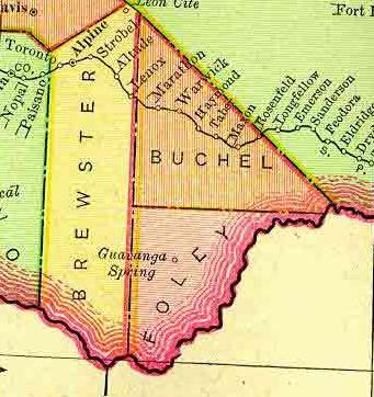
"Buchel and Foley County were both formed in March of 1887 from Presidio County. They were born together and both were annexed to Brewster County in 1897. A bill was passed to dissolve the counties, but Governor Charles Culberson never signed the papers. Nevertheless, the bill passed without the governor’s signature and the two counties were absorbed by Brewster County; making it the largest county in Texas."
Well, if there were 2 additional Texas counties I didn't know about, could there be more?
The answer is yes! All total, there were "at least thirty-two counties that were established by Texas law no longer exist. These defunct counties fall into five categories: (1) judicial counties; (2) counties established by declaration of the Constitutional Convention of 1868–69; (3) counties established by legislative act but never organized and later abolished by legislative act; (4) counties established outside the present boundaries of Texas; and (5) counties whose names have been changed." "DEFUNCT COUNTIES," Handbook of Texas Online
"The judicial counties were Burleson, Burnet, DeWitt, Guadalupe, Hamilton, La Baca, Madison, Menard, Neches, Panola, Paschal, Smith, Spring Creek, Trinity, Ward, and Waco.
"The Constitutional Convention of 1868–69, by declaration, attempted to organize Delta, Richland, Webster, and Latimer counties.
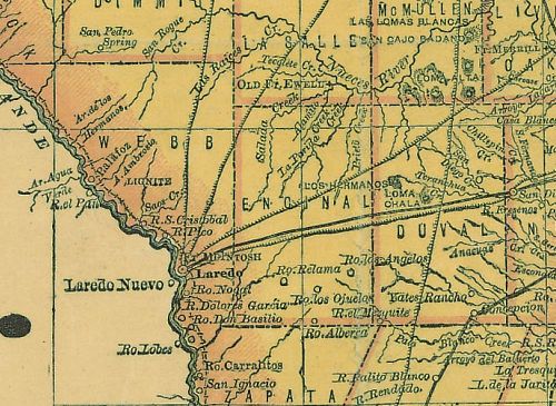
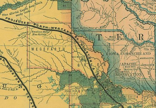
"The five counties authorized by the legislature but never organized were Buchel, Dawson, Encinal, Foley, and Wegefarth.
"Counties established outside the present boundaries of Texas were Greer, Worth, and Santa Fe, which were formed in areas that became parts of Oklahoma and New Mexico.
"Counties that were established under one name or functioned for a time under one name but have a different name at present include: Harrisburg County (changed to Harris County in 1839); Navasoto County (changed to Brazos County in 1842); Davis County (changed from Cass County in 1861 and back to Cass County in 1871);
Buchanan County (changed to Stephens County in 1861); and Cibolo County (changed from Wilson to Cibolo and then back to Wilson County)."
"DEFUNCT COUNTIES," Handbook of Texas Online
Here's a map of Wegefarth and Greer Counties. Greer County still exists, by the way. It's now in Oklahoma.
"Created 1860; until 1896, one of largest counties in Texas. Organized at Old Mobeetie, northwest of here. In 1880s settlement was rapid; by 1892 nearly 2,500 pupils were in county's schools. A post office, jail and many houses were built, and over 60,000 cattle grazed the 3,480 square miles of the county's area. But for a half-century (1846-1896) the United States and Texas waged a heated dispute over Greer County. Controversy had origin in an 1819 treaty fixing the line between United States and Spanish territory. A map designating the Red River and 100th meridian as boundary lines was part of treaty; but map aroused dispute, for it incorrectly marked 100th meridian and showed only one fork of two-forked Red River. Texas claimed the North Fork and meridian shown on map defined territory, and legislation and occupancy by Texans decided sovereignty. United States contended South Fork (larger of the two) and true 100th meridian marked boundaries. Three joint survey commissions failed to settle the issue. The U.S. Supreme Court in 1896 ruled that the region was in 1819 part of the Union and thus, was actually part of Oklahoma. Named for John A. Greer, Senator, Secretary of State, Republic of Texas; Lieutenant Governor, 1847-1853."
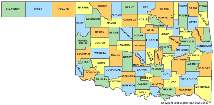
Texas County is a county located in the U.S. state of Oklahoma. Texas County was formed at Oklahoma statehood (16 November 1907) from the central one-third of "Old Beaver County" also known as "No Man's Land". When the formation of the county was authorized by the Constitutional Convention of 1907, the county was so named because it was wholly included within the limits of the Texas Cession of 1850, whereby the ownership of the area was passed from the State of Texas to the United States Government. From 1850 to 1890, its lands were never attached to any state or territory, never surveyed, and never divided into townships and sections. From 1890 to 1907, it was part of Beaver County.


 RSS Feed