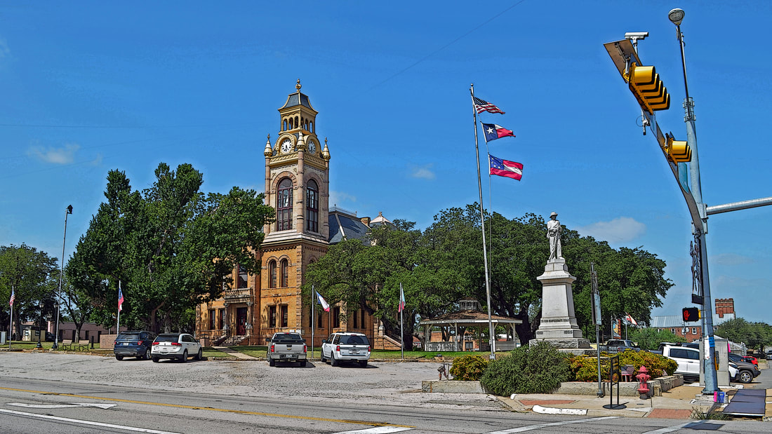
039 of 254: Llano County Courthouse, Llano, Texas. County Population: 19,301
 Llano County, Texas
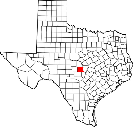
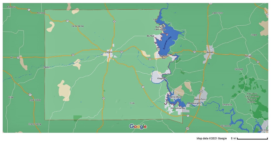
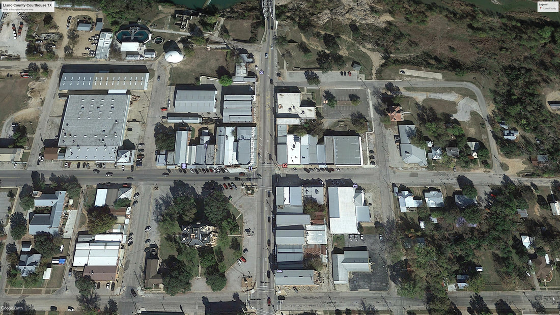
"Llano County, in Central Texas, is bounded on the north by San Saba County, on the east by Burnet County, on the south by Gillespie County, and on the west by Mason County. Llano County comprises 941 square miles of the Hill Country on the eastern part of the Edwards Plateau. Altitudes range from 800 to 2,000 feet above sea level.
"In 1847 John O. Meusebach, the leader of the German settlers, negotiated a treaty with the Comanches to permit Germans to live in the area of the Fisher-Miller Land Grant, which included what is now Llano County. After Meusebach's treaty, five settlements were established on or near the Llano River in what later became the western part of the county, but the town of Castell was the only one of these to survive. The settlement farthest downstream was Bettinaqv, a communal colony established by the "Society of Forty," a group of young men from German universities. Settlers began to move into the eastern part of the county shortly thereafter, the first ones settling at Tow Valley and Bluffton on the Colorado River in 1852.
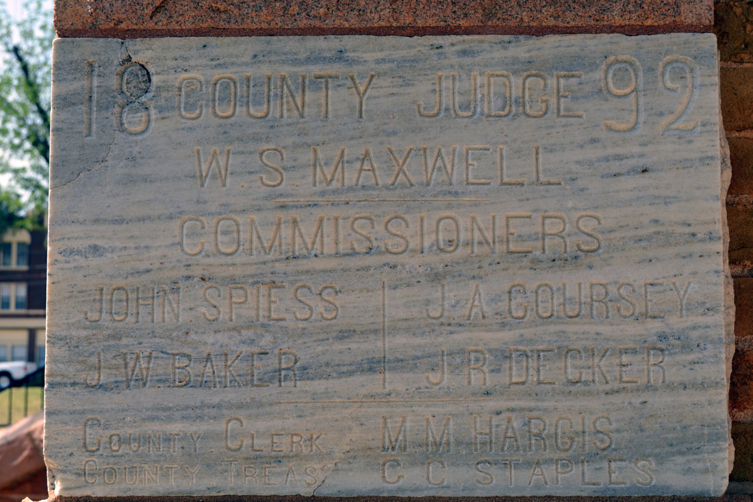
"Llano County was organized in 1856 after the Texas legislature formed the county from the Bexar District and Gillespie County. Donations of 250 acres were made for a site for the county seat.
"Llano County has for years been a major hunting area, the "Deer Capital of Texas." It leads the state in the number of white-tail deer harvested annually, with more than 12,000 killed each year. Wild turkeys are also hunted in the county. Other tourist attractions include the Bluebonnet Trail and Enchanted Rock State Natural Area."
Handbook of Texas Online, Ernest B. Speck, "LLANO COUNTY,"
"In 1847 John O. Meusebach, the leader of the German settlers, negotiated a treaty with the Comanches to permit Germans to live in the area of the Fisher-Miller Land Grant, which included what is now Llano County. After Meusebach's treaty, five settlements were established on or near the Llano River in what later became the western part of the county, but the town of Castell was the only one of these to survive. The settlement farthest downstream was Bettinaqv, a communal colony established by the "Society of Forty," a group of young men from German universities. Settlers began to move into the eastern part of the county shortly thereafter, the first ones settling at Tow Valley and Bluffton on the Colorado River in 1852.
"Llano County was organized in 1856 after the Texas legislature formed the county from the Bexar District and Gillespie County. Donations of 250 acres were made for a site for the county seat.
"Llano County has for years been a major hunting area, the "Deer Capital of Texas." It leads the state in the number of white-tail deer harvested annually, with more than 12,000 killed each year. Wild turkeys are also hunted in the county. Other tourist attractions include the Bluebonnet Trail and Enchanted Rock State Natural Area."
Handbook of Texas Online, Ernest B. Speck, "LLANO COUNTY,"
I visited Llano County and photographed the courthouse on March 27, 2010 and on June 30, 2018.
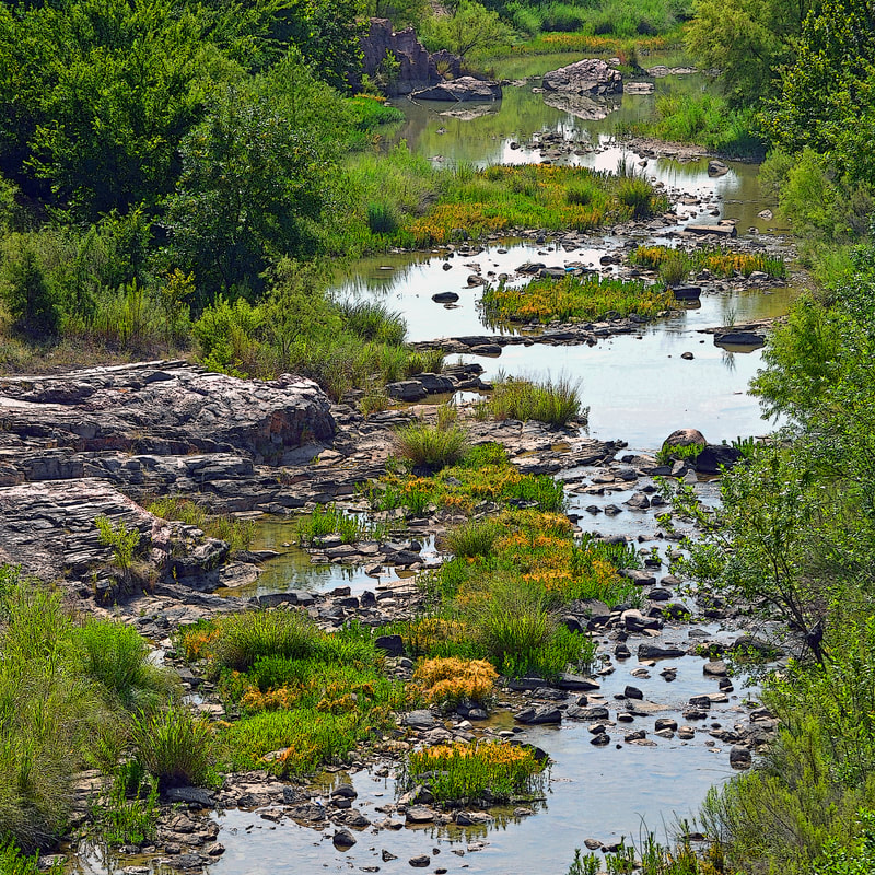
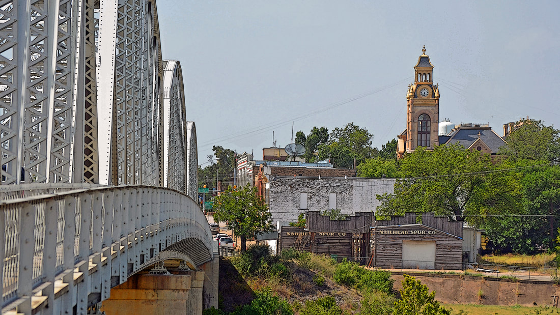
The Llano River
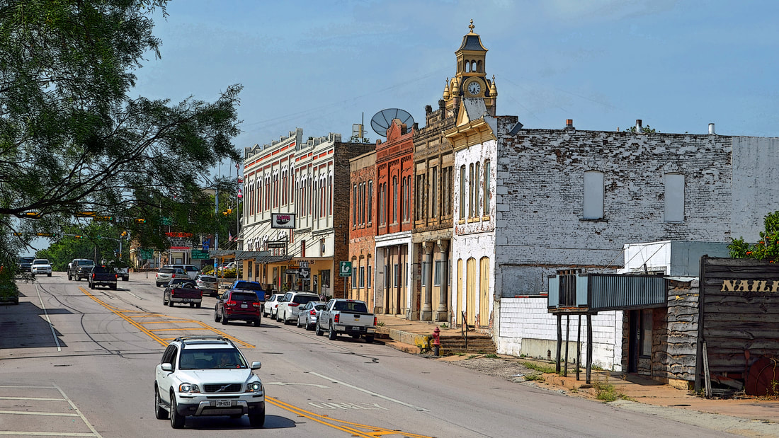
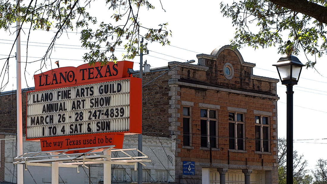
"The way Texas used to be."
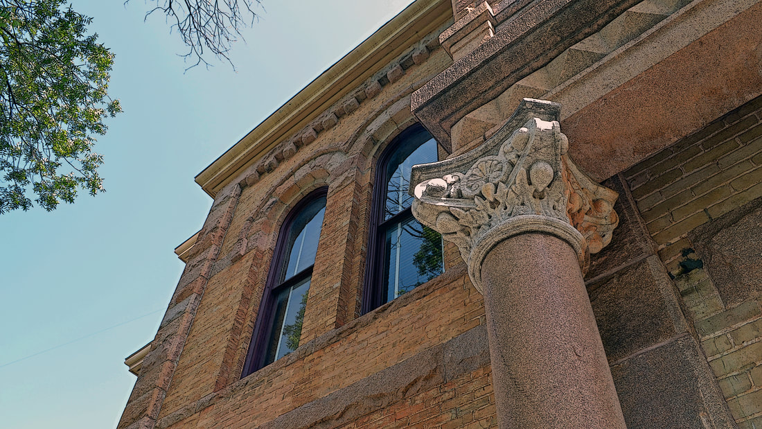
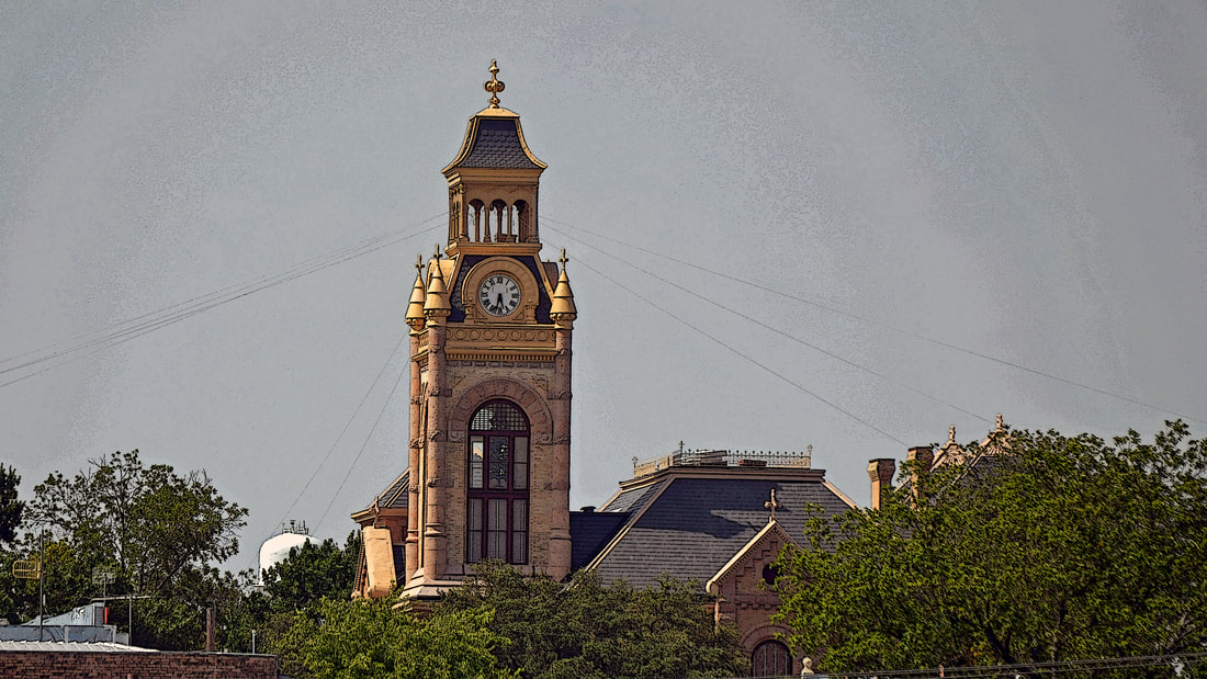
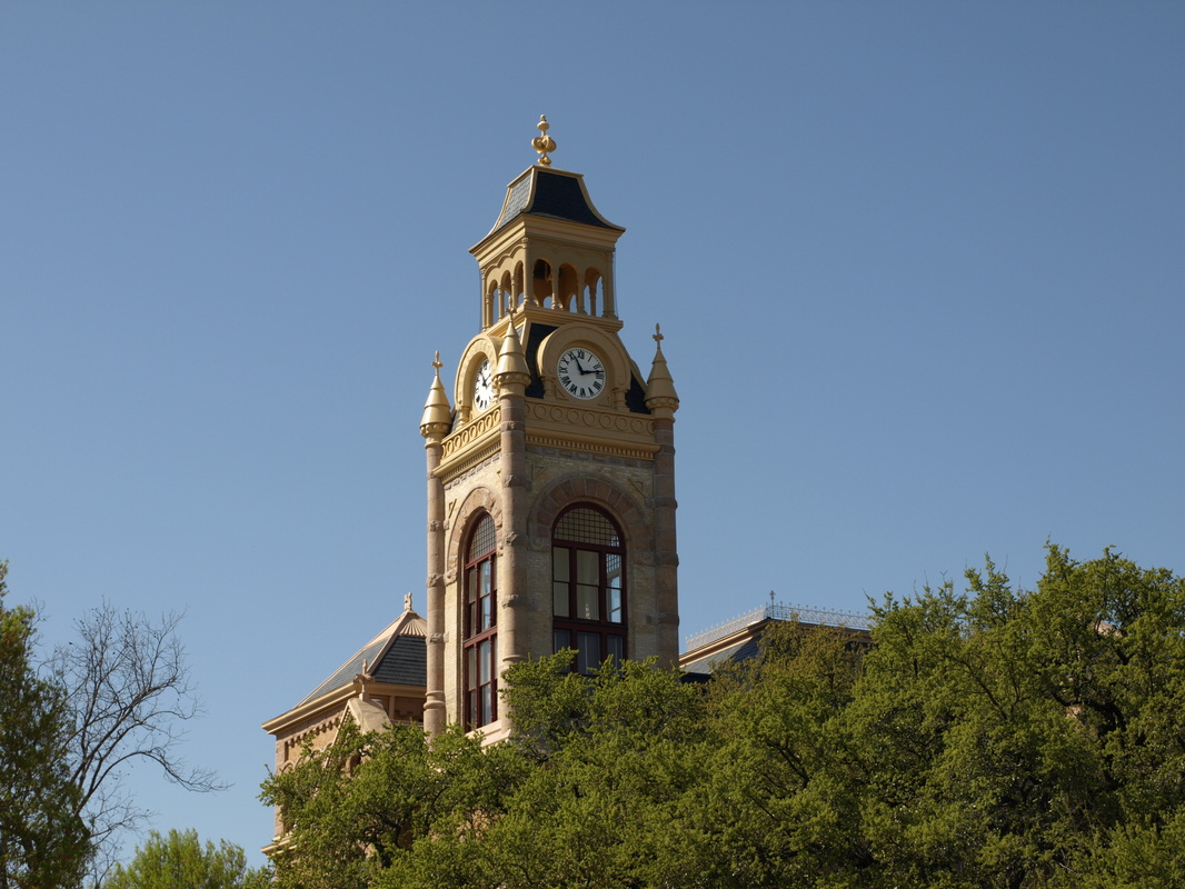
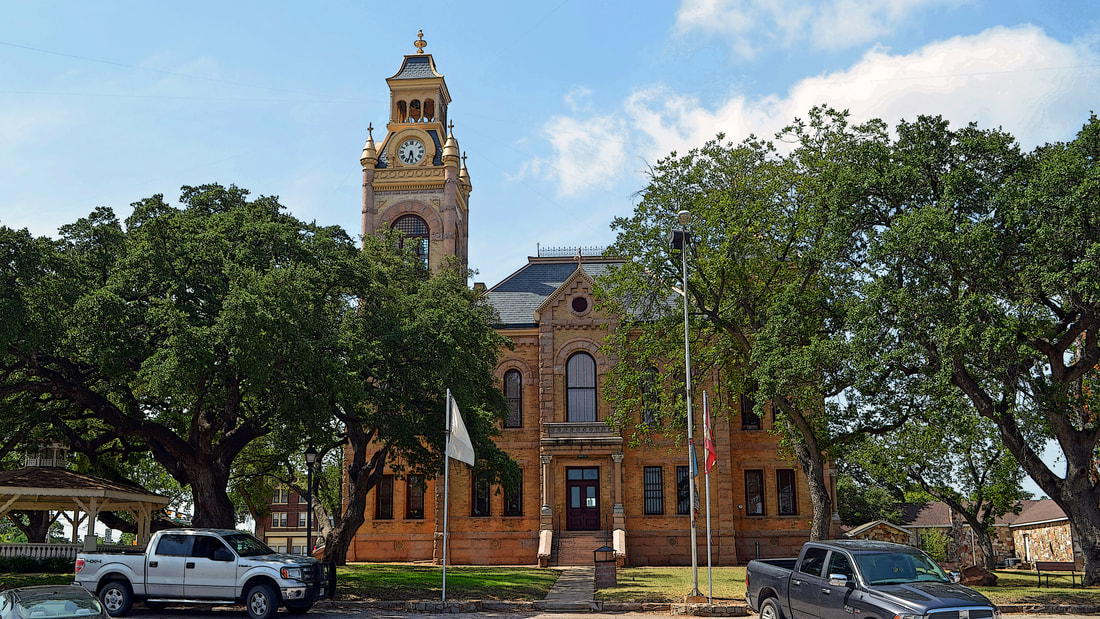
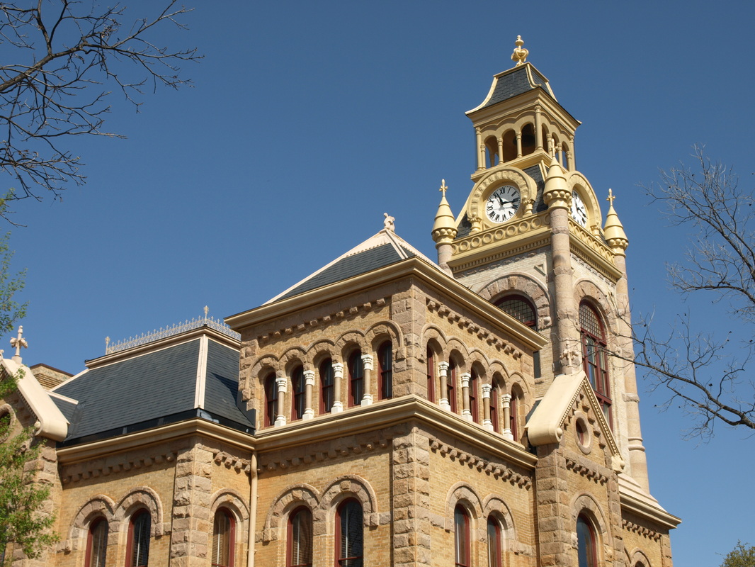
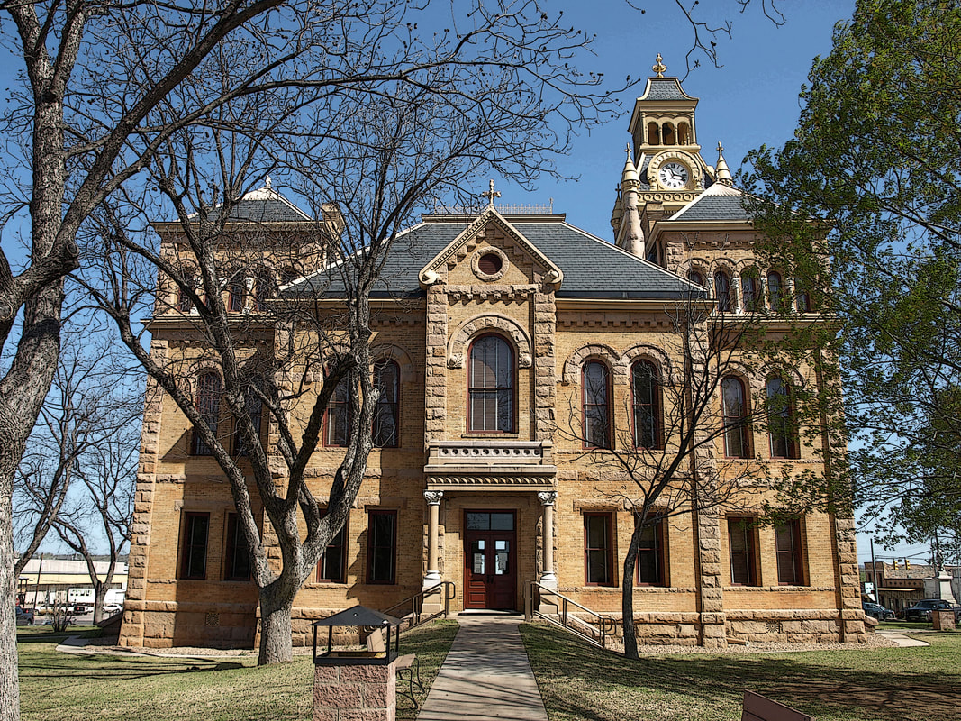
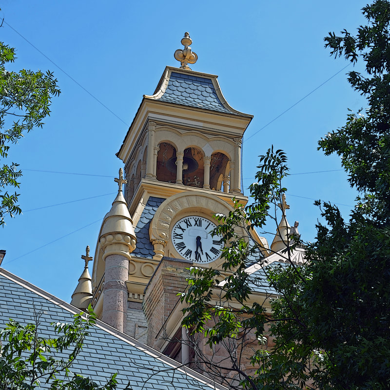
Llano County Courthouse 1892
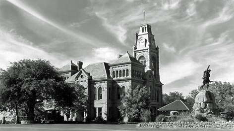
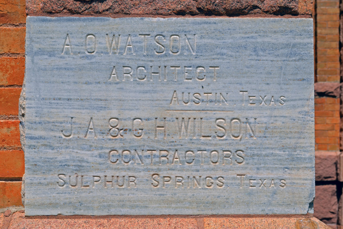
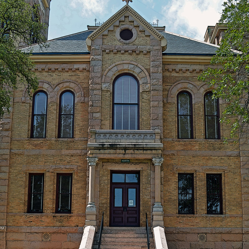
The 1892 courthouse, designed by the firm of A. 0. Watson, replaced a 1884 courthouse that was destroyed by fire. The ground floor is divided into four quadrants containing offices by corridors passing through the center of the building in the north-south and east-west directions. The large two-story courtroom along with four small rooms used by jurors, etc. occupies the second floor .
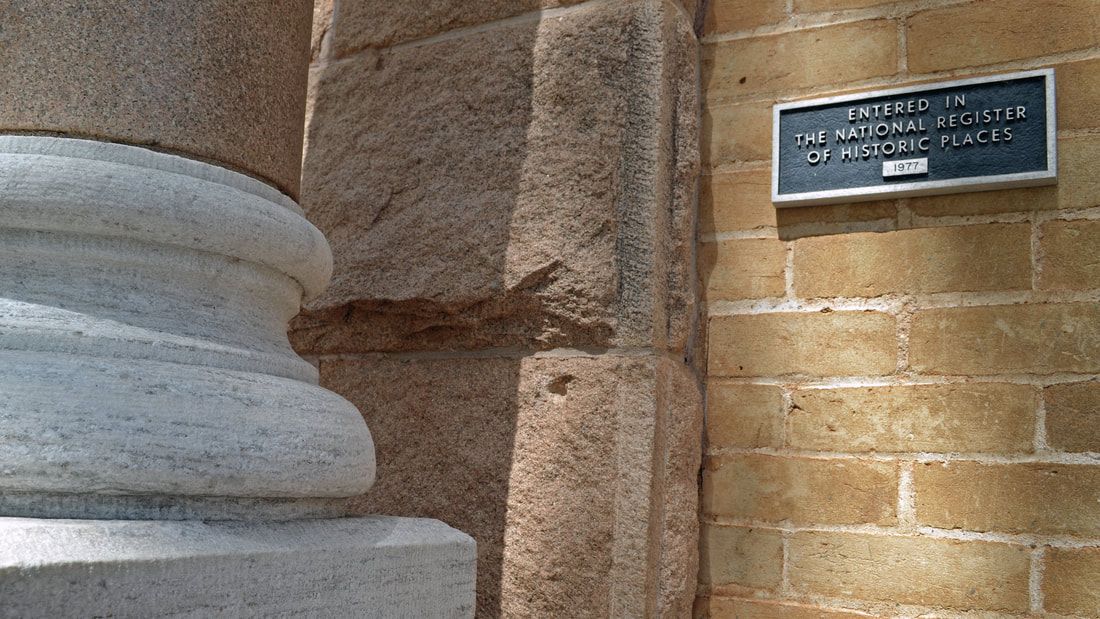
The building was restored in 2002. At that time the tower was returned to its original 1892 design. "The courthouse massing with a tower located on a corner rather than rising from the center is unusual in Texas and apparently had its origins in circumstances of site planning and in changes requested by the county commissioners during the course of planning . Evidently because the public square slopes downward appreciably to the northwest, it originally had been specified that the edifice be located on the southwest corner of the square. As a result of this requirement and the dictates of good composition, the architects placed the tower in an offset position on the southwest corner with entrances only on the south and west. Later the commissioners ordered the location moved to the center of the square and porticoes with designs matching those on the south and west were added to the north and east facades. Then the tower was moved to the northeast corner—the location of the cornerstone." The National Register nomination file - 1977
The building was restored in 2002. At that time the tower was returned to its original 1892 design. "The courthouse massing with a tower located on a corner rather than rising from the center is unusual in Texas and apparently had its origins in circumstances of site planning and in changes requested by the county commissioners during the course of planning . Evidently because the public square slopes downward appreciably to the northwest, it originally had been specified that the edifice be located on the southwest corner of the square. As a result of this requirement and the dictates of good composition, the architects placed the tower in an offset position on the southwest corner with entrances only on the south and west. Later the commissioners ordered the location moved to the center of the square and porticoes with designs matching those on the south and west were added to the north and east facades. Then the tower was moved to the northeast corner—the location of the cornerstone." The National Register nomination file - 1977
|
|
|
|